
5.8.24
Rachel Crowell
Simulations of underwater earthquakes and landslides in the Ionian Sea found that they could generate tsunami waves as high as 2.5 meters in southern Italy.
Earthquakes and landslides in the Ionian Sea could trigger tsunami waves as high as 2.5 meters (8 feet) on the southern coast of Italy, according to tsunami models presented at the December 2022 American Geophysical Union Fall Meeting in Chicago and published in a recent report from the Italian Ministry of Ecological Transition. The study focused on the coastal city of Crotone, in the Calabria region of Italy, also known as the “toe” of the boot-shaped peninsula.

The study region lies off the shores of southern Italy. The locations of three possible landslides (CMS, CCS, CRS) and five possible earthquakes (F1-F5) are denoted as blue stars, ranging from magnitude 6.0 to 6.9 (for F1-5 the magnitudes are 6.5, 6.9, 6.0, 6.7, 6.8, respectively). Credit: Gallotti et al. 2022
Why worry?
Italy is no stranger to earthquakes or tsunamis. Records dating back to the Roman era reveal devastating tsunamis that submerged coastal communities. One such tsunami occurred in 2002 when eruptions of the volcano Stromboli caused landslides that displaced enough water in the Tyrrhenian Sea to produce two tsunamis, with wave heights up to 10 meters (33 feet) on the island. Volcanic activity, offshore earthquakes and landslides have been responsible for tsunamis in Italy every few decades in the 20th century.
Motivated by increased gas extraction in the Adriatic, Ionian and Mediterranean seas by Italy and other Mediterranean nations, the Italian Ministry of Ecological Transition funded a study to explore the potential impacts of tsunami-generating earthquakes and landslides. The idea is that increased drilling and extraction in the tectonically active region could trigger earthquakes on pre-existing faults, which could generate tsunamis and also trigger tsunami-generating underwater landslides.
Modeling different scenarios
In the first stage of a three-phase research project, researchers estimated the potential for earthquakes on offshore faults. “The earthquake scenarios are based on local structures that have been studied and identified,” explains Filippo Zaniboni and Alberto Armigliato, geophysicists at the University of Bologna in Italy who co-authored the tsunami study. The researchers also mapped unstable underwater slopes that could collapse in a landslide. Both earthquake and landslide hazards have the potential to move large volumes of water, causing a tsunami. This investigation involved the whole Italian coast, providing a first larger scale assessment of the background tsunami hazard connected to natural causes (see Antoncecchi et al., 2020).

Five tsunami wave height scenarios based on undersea earthquakes. Scenario earthquake epicenters are marked with a yellow star and have magnitudes 6.5, 6.9, 6.0, 6.7, and 6.8, respectively. Scenario F2 produces the largest wave along the coastline. Scenarios F4 and F5 are different magnitude earthquakes on the same fault structure. Credit: Gallotti et al. 2022
In the second phase of the project, the study focused on a specific site — the coastal stretch around Crotone. Zaniboni and his co-authors simulated tsunami scenarios to find out just how much inundation the coast could experience. They modeled tsunami waves triggered by a variety of possible underwater earthquake and landslide scenarios.
While earthquakes are a common trigger for landslides, many other mechanisms can contribute to underwater slope failures, Zaniboni says. For unstable slopes under the sea, water intrusion and sea level changes, underwater currents, and the presence of gas can all contribute to the instability of slopes, which can lead to landslides.
The researchers considered three possible landslide scenarios. Two of the scenarios involve larger displaced volumes (about 0.4-0.5 cubic kilometers, or 14-15 billion cubic feet) and occur farther offshore, at underwater depths from 750-1,250 meters (2,500 to 4,100 feet). The third scenario was a smaller landslide scenario (about 0.2 cubic kilometers or 7 billion cubic feet) located closer to shore (at depths from about 400-700 meters, or 1,300 to 1,700 feet).
In their modeling, the largest wave was produced by the smaller landslide. Whereas the two larger landslides are “slump-like” scenarios in which the land mass would move all at once as a single unit and then stop, the smaller landslide was expected to behave as a debris flow, a type of landslide that typically maintains higher speeds over a longer time. The smaller landslide also exhibited more complex dynamics because it would travel along an underwater canyon that would make it speed up and slow down several times.
Earthquake scenarios ranged from magnitude 6.0 to 6.9 and could produce waves as high as 2 meters (6.6 feet). Landslides, which could be triggered by earthquakes or by other processes, could result in even larger tsunami waves, as high as 2.5 meters (8 feet). While none of the simulated tsunamis would be catastrophic, Zaniboni points out that local features like harbor basins and river mouths can enhance tsunami waves and cause greater inundation. A more detailed study of the most affected coastal areas could provide better estimates of how a tsunami would impact Crotone and its harbor, he notes.

Three tsunami wave height scenarios generated from simulations of underwater landslides. Landslide areas are outlined in purple. The smallest volume and shallowest landslide, CCS, produces the largest wave along the coast. Credit: Gallotti et al. 2022
Evaluating tsunami hazards
“It’s a solid set of models; they work well” says Elena Suleimani, a tsunami modeler at the Alaska Earthquake Center at University of Fairbanks, Alaska. But Suleimani says she’s not aware of any tsunamis triggered by extraction. For example, decades of offshore drilling in the offshore Alaska region have not caused tsunamis.
Offshore gas storage was blamed for hundreds of small earthquakes in Spain in 2013, and the Netherlands has experienced many small earthquakes after decades of natural gas drilling. In the midwestern U.S., there has been a significant rise in induced earthquakes from wastewater injection associated with hydrofracturing or “fracking” for natural gas — a special process for extracting gas from tight reservoirs.
Although the Ionian Sea tsunami research was motivated by concerns about offshore drilling, the earthquake and landslide scenarios are based on existing faults and underwater slopes. These natural conditions could cause tsunamis regardless of gas extraction in the region, according to Zaniboni.
These tsunami scenarios will now be passed on to regional city planners and engineers who can assess the tsunami threat. The third phase of the project will involve the consideration of ways to protect coastal communities.
References
Antoncecchi, I., Ciccone, F., Dialuce, G., Grandi, S., Terlizzese, F., Di Bucci, D.,…& Prota, A. (2020) – Progetto SPOT – Sismicità Potenzialmente innescabile Offshore e Tsunami. Report integrato di fine progetto. DOI: 10.5281/zenodo.3732887 ISBN 9788894366945 (in Italian).
Gallotti, G., Armigliato, A., Zaniboni, F., Angeli, C., Zanetti, M, Argnani, A., and Rovere, M. (2022) Tsunami Scenarios Offshore the Calabria Region Ionian Coast, Italy. American Geophysical Union Fall Meeting, Dec. 2022, Chicago, IL, USA.
See the full article here .
Comments are invited and will be appreciated, especially if the reader finds any errors which I can correct.

five-ways-keep-your-child-safe-school-shootings
Please help promote STEM in your local schools.
![]()
Stem Education Coalition
_________________________________________
ShakeAlert Earthquake Alert Early Warning Labs, LLC (EWL)
![]()
![]()
Earthquake Network project smartphone ap is a research project which aims at developing and maintaining a crowdsourced smartphone-based earthquake warning system at a global level. Smartphones made available by the population are used to detect the earthquake waves using the on-board accelerometers. When an earthquake is detected, an earthquake warning is issued in order to alert the population not yet reached by the damaging waves of the earthquake.
The project started on January 1, 2013 with the release of the homonymous Android application Earthquake Network. The author of the research project and developer of the smartphone application is Francesco Finazzi of the University of Bergamo, Italy.
Get the app in the Google Play store.
Smartphone network spatial distribution (green and red dots) on December 4, 2015

About Early Warning Labs, LLC
Early Warning Labs, LLC (EWL) is an Earthquake Early Warning technology developer and integrator located in Santa Monica, CA. EWL is partnered with industry leading GIS provider ESRI, Inc. and is collaborating with the US Government and university partners.
EWL is investing millions of dollars over the next 36 months to complete the final integration and delivery of Earthquake Early Warning to individual consumers, government entities, and commercial users.
EWL’s mission is to improve, expand, and lower the costs of the existing earthquake early warning systems.
EWL is developing a robust cloud server environment to handle low-cost mass distribution of these warnings. In addition, Early Warning Labs is researching and developing automated response standards and systems that allow public and private users to take pre-defined automated actions to protect lives and assets.
EWL has an existing beta R&D test system installed at one of the largest studios in Southern California. The goal of this system is to stress test EWL’s hardware, software, and alert signals while improving latency and reliability.
ShakeAlert: An Earthquake Early Warning System for the West Coast of the United States

The U. S. Geological Survey (USGS) along with a coalition of State and university partners is developing and testing an earthquake early warning (EEW) system called ShakeAlert for the west coast of the United States. Long term funding must be secured before the system can begin sending general public notifications, however, some limited pilot projects are active and more are being developed. The USGS has set the goal of beginning limited public notifications in 2018.
Watch a video describing how ShakeAlert works in English or Spanish.
The primary project partners include:
United States Geological Survey
California Governor’s Office of Emergency Services (CalOES)
California Geological Survey California Institute of Technology
University of California-Berkeley
University of Washington
University of Oregon
Gordon and Betty Moore Foundation
The Earthquake Threat
Earthquakes pose a national challenge because more than 143 million Americans live in areas of significant seismic risk across 39 states. Most of our Nation’s earthquake risk is concentrated on the West Coast of the United States. The Federal Emergency Management Agency (FEMA) has estimated the average annualized loss from earthquakes, nationwide, to be $5.3 billion, with 77 percent of that figure ($4.1 billion) coming from California, Washington, and Oregon, and 66 percent ($3.5 billion) from California alone. In the next 30 years, California has a 99.7 percent chance of a magnitude 6.7 or larger earthquake and the Pacific Northwest has a 10 percent chance of a magnitude 8 to 9 megathrust earthquake on the Cascadia subduction zone.
Part of the Solution
Today, the technology exists to detect earthquakes, so quickly, that an alert can reach some areas before strong shaking arrives. The purpose of the ShakeAlert system is to identify and characterize an earthquake a few seconds after it begins, calculate the likely intensity of ground shaking that will result, and deliver warnings to people and infrastructure in harm’s way. This can be done by detecting the first energy to radiate from an earthquake, the P-wave energy, which rarely causes damage. Using P-wave information, we first estimate the location and the magnitude of the earthquake. Then, the anticipated ground shaking across the region to be affected is estimated and a warning is provided to local populations. The method can provide warning before the S-wave arrives, bringing the strong shaking that usually causes most of the damage.
Studies of earthquake early warning methods in California have shown that the warning time would range from a few seconds to a few tens of seconds. ShakeAlert can give enough time to slow trains and taxiing planes, to prevent cars from entering bridges and tunnels, to move away from dangerous machines or chemicals in work environments and to take cover under a desk, or to automatically shut down and isolate industrial systems. Taking such actions before shaking starts can reduce damage and casualties during an earthquake. It can also prevent cascading failures in the aftermath of an event. For example, isolating utilities before shaking starts can reduce the number of fire initiations.
System Goal
The USGS will issue public warnings of potentially damaging earthquakes and provide warning parameter data to government agencies and private users on a region-by-region basis, as soon as the ShakeAlert system, its products, and its parametric data meet minimum quality and reliability standards in those geographic regions. The USGS has set the goal of beginning limited public notifications in 2018. Product availability will expand geographically via ANSS regional seismic networks, such that ShakeAlert products and warnings become available for all regions with dense seismic instrumentation.
Current Status
The West Coast ShakeAlert system is being developed by expanding and upgrading the infrastructure of regional seismic networks that are part of the Advanced National Seismic System (ANSS); the California Integrated Seismic Network (CISN) is made up of the Southern California Seismic Network, SCSN) and the Northern California Seismic System, NCSS and the Pacific Northwest Seismic Network (PNSN). This enables the USGS and ANSS to leverage their substantial investment in sensor networks, data telemetry systems, data processing centers, and software for earthquake monitoring activities residing in these network centers. The ShakeAlert system has been sending live alerts to “beta” users in California since January of 2012 and in the Pacific Northwest since February of 2015.
In February of 2016 the USGS, along with its partners, rolled-out the next-generation ShakeAlert early warning test system in California joined by Oregon and Washington in April 2017. This West Coast-wide “production prototype” has been designed for redundant, reliable operations. The system includes geographically distributed servers, and allows for automatic fail-over if connection is lost.
This next-generation system will not yet support public warnings but does allow selected early adopters to develop and deploy pilot implementations that take protective actions triggered by the ShakeAlert notifications in areas with sufficient sensor coverage.
Authorities
The USGS will develop and operate the ShakeAlert system, and issue public notifications under collaborative authorities with FEMA, as part of the National Earthquake Hazard Reduction Program, as enacted by the Earthquake Hazards Reduction Act of 1977, 42 U.S.C. §§ 7704 SEC. 2.
For More Information
Robert de Groot, ShakeAlert National Coordinator for Communication, Education, and Outreach
rdegroot@usgs.gov
626-583-7225
ShakeAlert Implementation Plan
Earthquake Early Warning Introduction
The United States Geological Survey (USGS), in collaboration with state agencies, university partners, and private industry, is developing an earthquake early warning system (EEW) for the West Coast of the United States called ShakeAlert. The USGS Earthquake Hazards Program aims to mitigate earthquake losses in the United States. Citizens, first responders, and engineers rely on the USGS for accurate and timely information about where earthquakes occur, the ground shaking intensity in different locations, and the likelihood is of future significant ground shaking.
The ShakeAlert Earthquake Early Warning System entered its first phase of operations. The USGS working in partnership with the California Governor’s Office of Emergency Services (Cal OES) is now allowing for the testing of public alerting via apps, Wireless Emergency Alerts, and by other means throughout California.
ShakeAlert partners in Oregon and Washington are working with the USGS to test public alerting in those states sometime in 2020.
ShakeAlert has demonstrated the feasibility of earthquake early warning, from event detection to producing USGS issued ShakeAlerts ® and will continue to undergo testing and will improve over time. In particular, robust and reliable alert delivery pathways for automated actions are currently being developed and implemented by private industry partners for use in California, Oregon, and Washington.
Earthquake Early Warning Background
The objective of an earthquake early warning system is to rapidly detect the initiation of an earthquake, estimate the level of ground shaking intensity to be expected, and issue a warning before significant ground shaking starts. A network of seismic sensors detects the first energy to radiate from an earthquake, the P-wave energy, and the location and the magnitude of the earthquake is rapidly determined. Then, the anticipated ground shaking across the region to be affected is estimated. The system can provide warning before the S-wave arrives, which brings the strong shaking that usually causes most of the damage. Warnings will be distributed to local and state public emergency response officials, critical infrastructure, private businesses, and the public. EEW systems have been successfully implemented in Japan, Taiwan, Mexico, and other nations with varying degrees of sophistication and coverage.
Earthquake early warning can provide enough time to:
Instruct students and employees to take a protective action such as Drop, Cover, and Hold On
Initiate mass notification procedures
Open fire-house doors and notify local first responders
Slow and stop trains and taxiing planes
Install measures to prevent/limit additional cars from going on bridges, entering tunnels, and being on freeway overpasses before the shaking starts
Move people away from dangerous machines or chemicals in work environments
Shut down gas lines, water treatment plants, or nuclear reactors
Automatically shut down and isolate industrial systems
However, earthquake warning notifications must be transmitted without requiring human review and response action must be automated, as the total warning times are short depending on geographic distance and varying soil densities from the epicenter.
GNSS-Global Navigational Satellite System
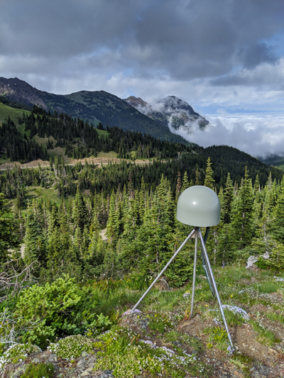
GNSS station | Pacific Northwest Geodetic Array, Central Washington University
_________________________________________